 |
||||
integrated approaches to watersheds-planning-facilitation |
||||
 |
||

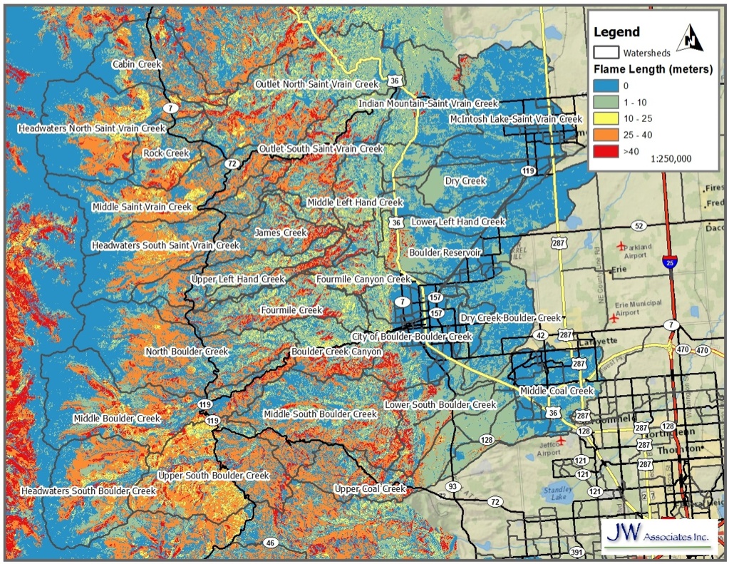
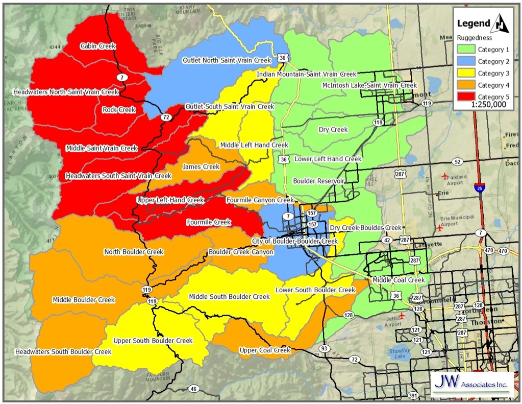
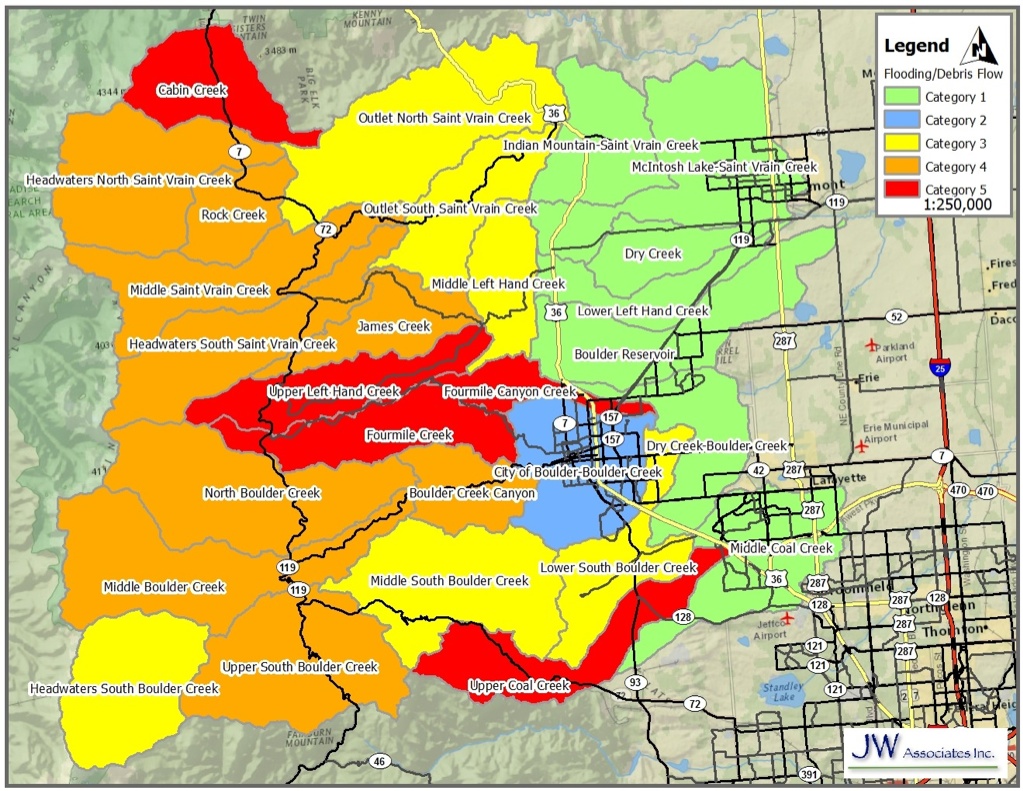
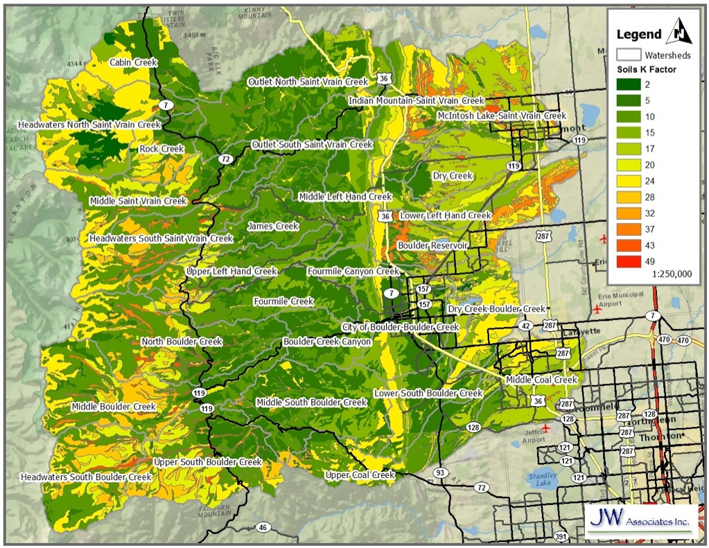
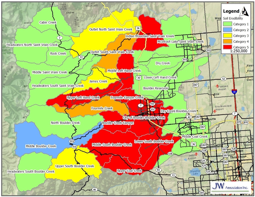
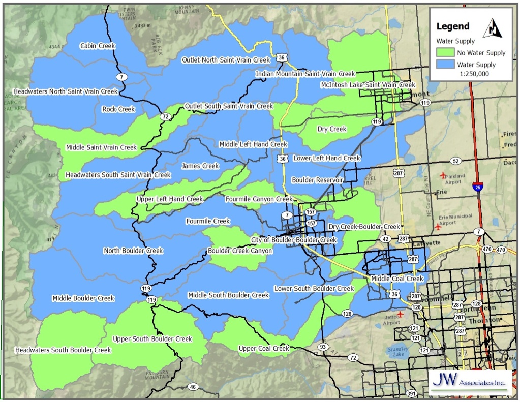
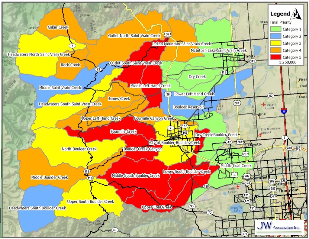
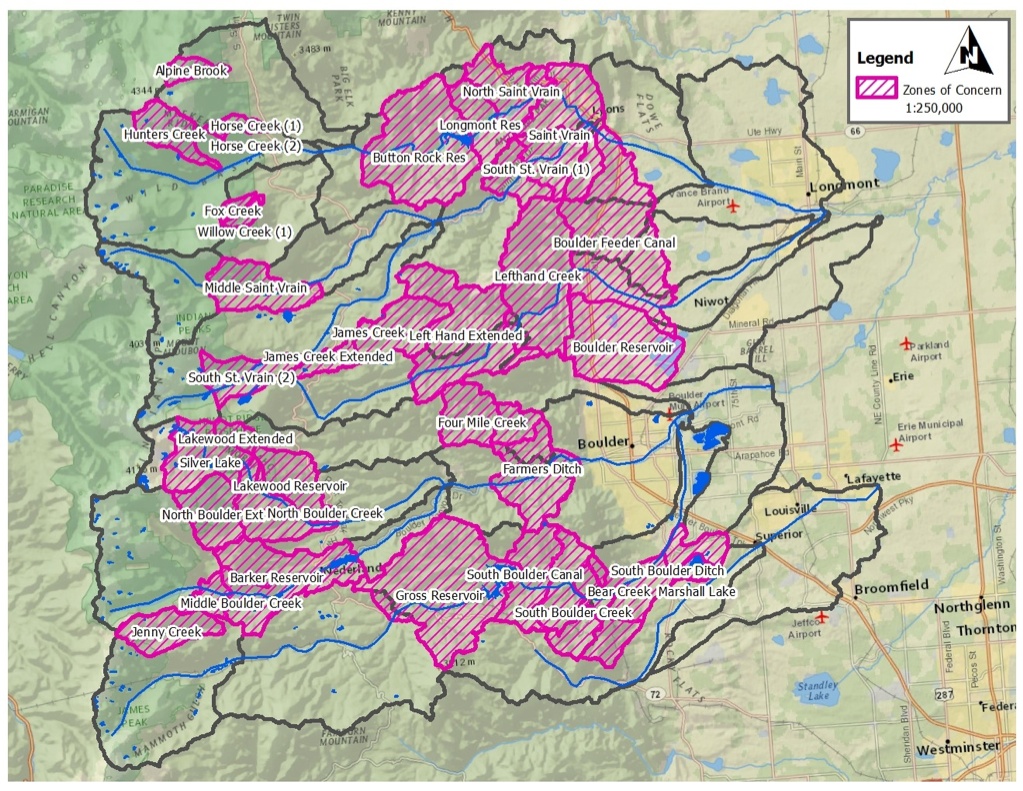
Saint Vrain Wildfire/Watershed Assessment We have completed a wildfire/watershed assessment and prioritization for the Saint Vrain Watershed. The Saint Vrain Watershed includes the St. Vrain , Boulder, Lefthand and Coal Creeks. The assessment followed a procedure prescribed by the Front Range Watershed Protection Data Refinement Work Group titled “Protecting Critical Watersheds in Colorado from Wildfire: A Technical Approach to Watershed Assessment and Prioritization”. See the Watershed Wildfire Protection Group page for more information. The Saint Vrain Wildfire/Watershed Assessment identifies, prioritizes, and recommends measures to protect those watersheds that provide or convey critical community water supplies from the adverse effects of post-wildfire hydrologic changes, including flooding, erosion, deposition, and introduction of potential contaminants. One of the goals of this assessment is to gather the key stakeholders together to communicate the suggested process, listen to any suggested changes, and build collaborative support for the assessment process. We had four stakeholder meetings and one public meeting. The report and related documents can be found below in the Documents section. A slide show of the maps from the report can be viewed below in the Maps section. The basic analysis for the Saint Vrain Watershed was completed as part of the Bark Beetle Incident Watershed work. Please contact Brad Piehl for further information |
|||||||
 |
|||||||
Contact Us 970.406.0085 |
|||||||
 |
||
Saint Vrain Wildfire/Watershed Assessment Documents Saint Vrain Wildfire/Watershed Assessment Report V4 Mountain Pine Beetle Progression Powerpoint Saint Vrain Stakeholders Meeting #4 Agenda Saint Vrain Watershed Analysis Tables Saint Vrain Stakeholders Meeting #1 Agenda Saint Vrain Stakeholders Meeting #2 Agenda Saint Vrain Stakeholders Meeting #3 Agenda Saint Vrain Public Meeting Flyer
Button Rock Reservoir ZoC Maps Rocky Mountain National Park ZoC Maps ________________________________________________________ Saint Vrain Wildfire/Watershed Assessment Maps The maps in the slide show below are from the Saint Vrain Wildfire/Watershed Assessment. Click on the slide show to view the priority maps. The legend text identifies the item that the priority is based on. Descriptions of the maps and how they were created are contained in the report located above in the Documents section. |
||
