 |
||||
integrated approaches to watersheds-planning-facilitation |
||||
 |
||

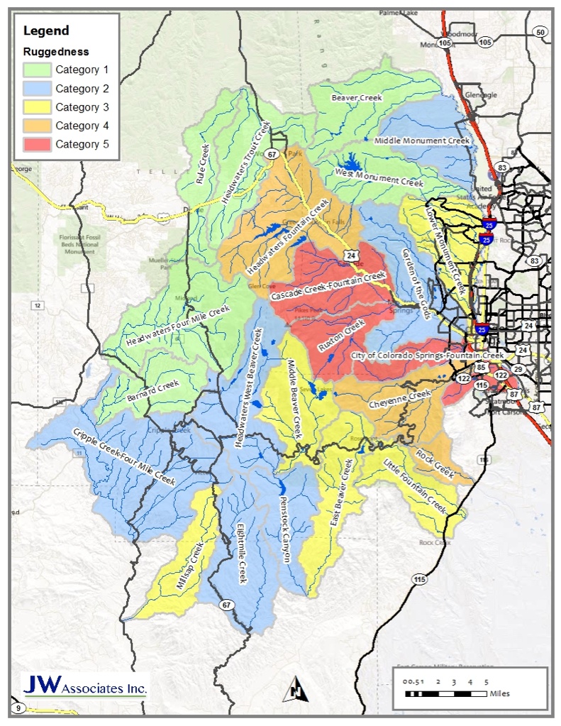
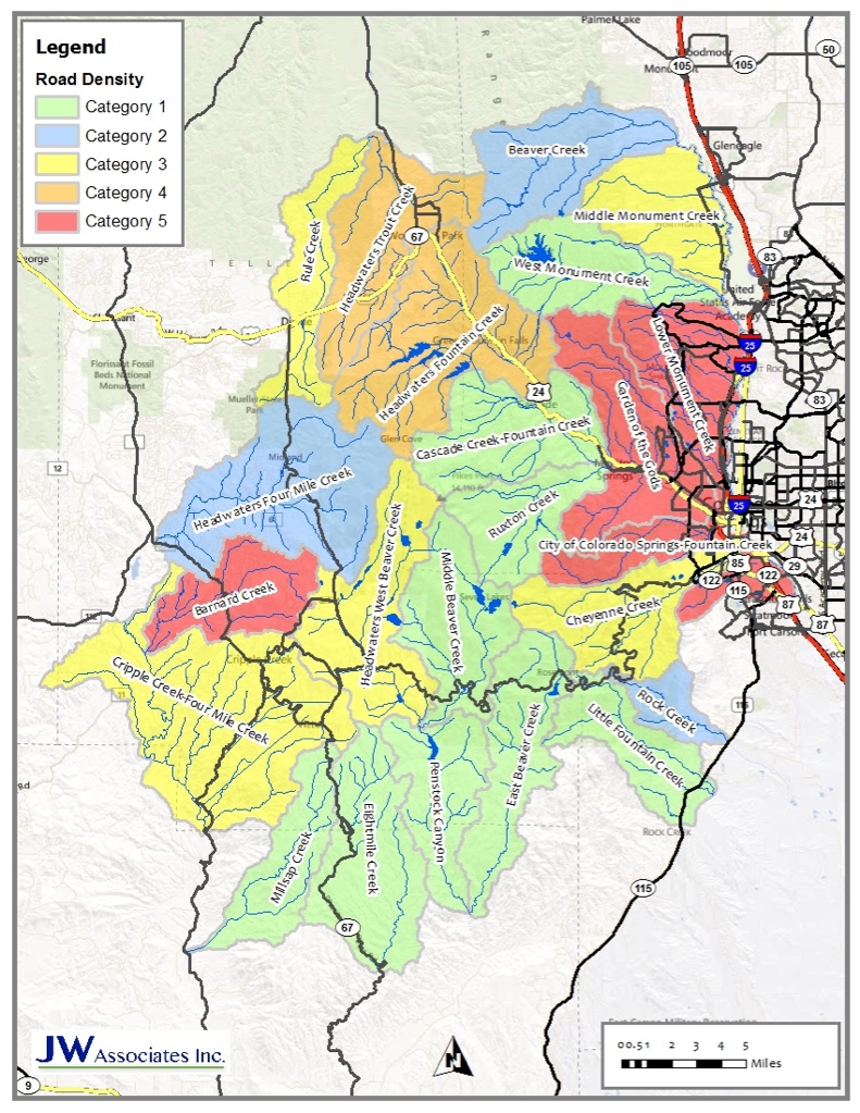
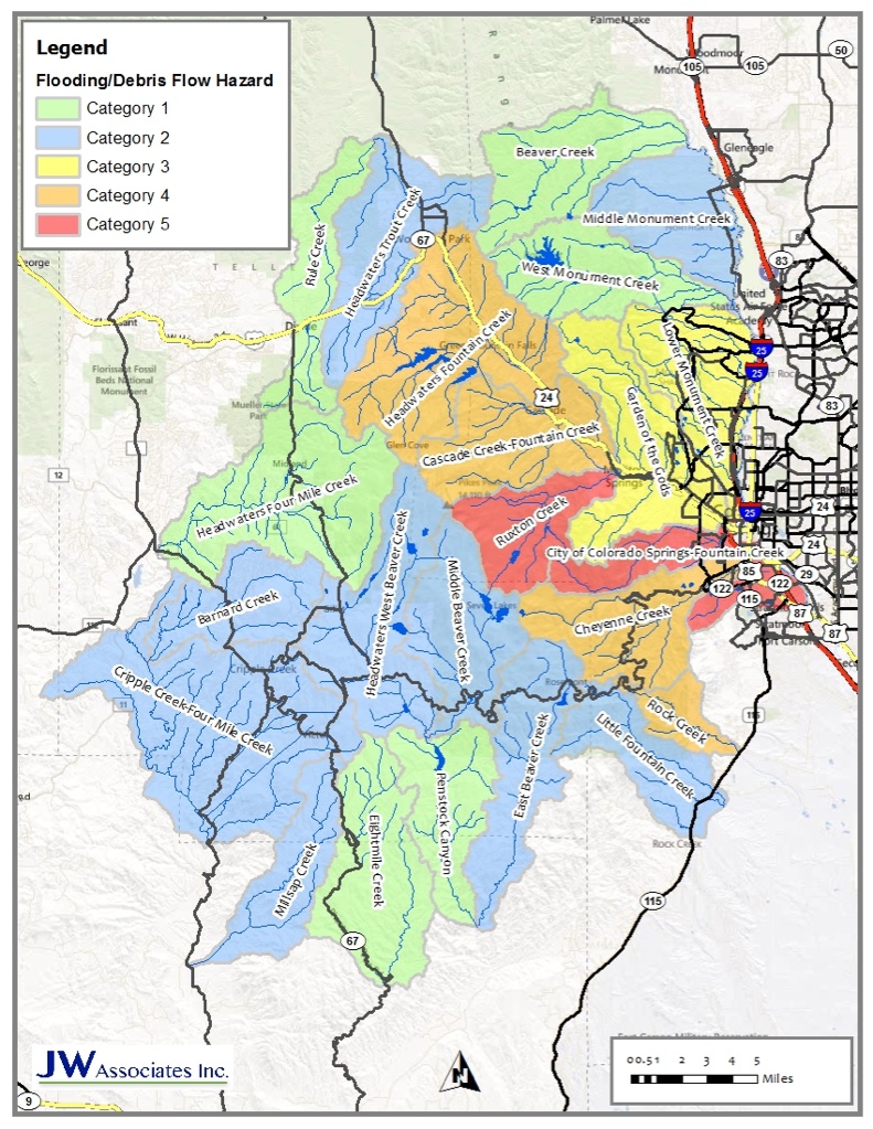
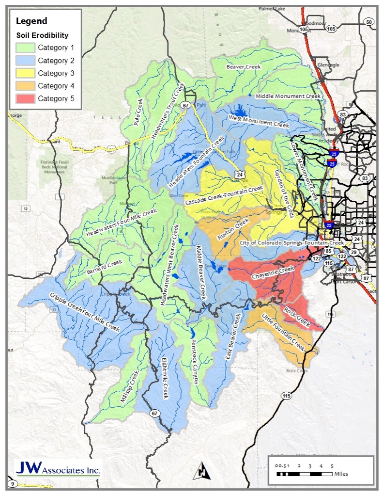
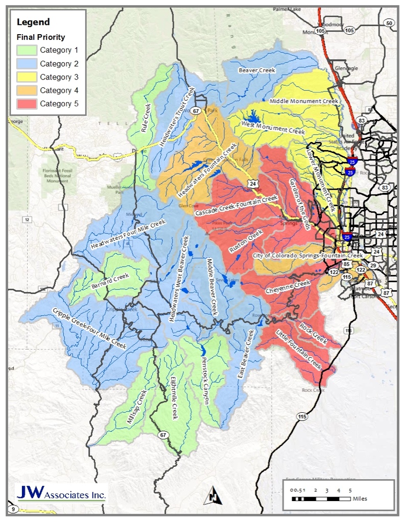
Pikes Peak Wildfire/Watershed Assessment We have completed the Pikes Peak Watershed/Wildfire Assessment. The assessment follows a procedure prescribed by the Colorado Watershed Protection Data Refinement Work Group titled “Protecting Critical Watersheds in Colorado from Wildfire: A Technical Approach to Watershed Assessment and Prioritization”. See Watershed Wildfire Protection Group for more information. The Pikes Peak Wildfire/Watershed Assessment identifies, prioritizes, and recommends measures to protect those watersheds that provide or convey critical community water supplies from the adverse effects of post-wildfire hydrologic changes, including flooding, erosion, debris flows, and deposition. We also completed an opportunities and constraints analysis to identify potential next steps for watershed protection. The report and related documents can be found below in the Documents section. A slide show of the maps from the report can be viewed below in the Maps section. Please contact Brad Piehl for further information. Pikes Peak Wildfire Watershed Assessment Documents Pikes Peak Wildfire/Watershed Assessment Report V5...Download Pikes Peak Watershed Analysis Tables Pikes Peak Stakeholders Meeting #1 Agenda Pikes Peak Stakeholders Meeting #2 Agenda Pikes Peak Stakeholders Meeting #3 Agenda Pikes Peak Watershed Priority GIS Shapefiles Pikes Peak Zones of Concern GIS Shapefiles Pikes Peak Wildfire Watershed Assessment Maps The maps in the slide show below are from the Pikes Peak Wildfire/Watershed Assessment. Click on the slide show to view the priority maps. The legend text identifies the item that the priority is based on. Descriptions of the maps and how they were created are contained in the report located above in the Documents section. |
|||||||
 |
|||||||
Contact Us 970.406.0085 |
|||||||
