 |
||||
integrated approaches to watersheds-planning-facilitation |
||||
 |
||

 |
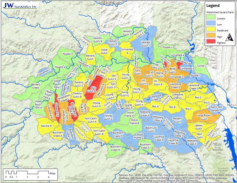
High Park Fire Watershed Protection We are working on targeting watershed protrection measures following the High Park Fire west of Fort Collins, Colorado. The Hign Park Fire burned started on June 9, 2012 and was contained on July 1, 2012. It burned 87,200 acres on multiple land jurisdictions. It was the one of the largest and most destructive fires in the history of Colorado, destroying 259 homes and cabins, and disrupting the lives of hundreds of residents. This page is being used as a source of information sharing related to the High Park Fire mitigation and watershed protection. A series of maps are available on the High Park Maps page. Background and analysis documents are available on the High Park Documents page. We are also maintaining an FTP site for collection and disersal of GIS data. Please contact Brad Piehl for further information.
|
||||||
Contact Us 970.406.0085 |
|||||||
 |
||